![]()
MAPS OF METROPOLITAN LIMA
Area: Provinces of Lima and Callao (including Ancón, Chosica and Pucusana)
Presentations:
|
 |
* Approximate scale
 |
|
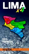
GUIA 'LIMAx4'
(GUIDE BY DISTRICTS) Presentation: booklet of 12 x 21 cm, full color district maps in format A4, alphabetical index included Scales: various (according to the size of each district) Use: for office, car, or as pocket guide Area: Provinces of Lima and Callao |
![]()
|
GUIA
2000 Presentation: booklet of 12 x 17 cm, 56 full color partial maps, alphabetical index included Scale: 1:25,000 Use: for office, car, or as pocket guide Area: Provinces of Lima and Callao |
![]()
|
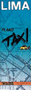
PLANO 'TAXI'
Presentation: printed in full color on thin cardboard format A3, folded to 10.5 x 29.7cm; laminated on both sides Scale: 1:60,000 (approx.) Contents: General map of Metropolitan Lima (with highways, main avenues and other important streets; districts, principal neighborhoods; points of interest; 1 km grid, detailed maps of downtown Lima, San Isidro and Miraflores, panoramic view of provinces of Lima and Callao) Use: the whole city at a glance, for planning routes etc. Area: Metropolitan Lima and Callao |
![]()
|
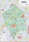
DISTRICT
MAPS Presentation: Plotted in full color on 120 g paper, format A3 and A2 Scales: various (according to the size of each district) Contents: same as Mural Maps Use: for offices Area: All districts of Metropolitan Lima and Callao |
 |
|
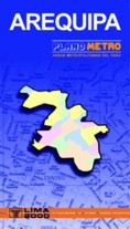
PLANO
METRO AREQUIPA Presentation: sheet of 70 x 100 cm, full color, folded to 11.5 x 20 cm Scale: 1:18,000 (approx.) Use: for tourism, households, schools Area: City of Arequipa |
![]()
|
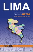
PLANO
METRO LIMA Presentation: sheet of 70 x 100 cm, folded, 6 colors, alphabetical index on backside Scale: 1:35,000 (approx.) Use: for tourism, households, schools Area: Metropolitan Lima and Callao |
![]()
|
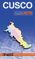
PLANO
METRO CUSCO Presentation: sheet of 50 x 70 cm, full color, folded to 11.5 x 20 cm Scale: 1:15,000 (approx.) Use: for tourism, households, schools Area: City of Cusco |
![]()
|
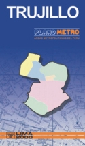
PLANO
METRO TRUJILLO Presentation: sheet of 70 x 100 cm, full color, folded to 11.5 x 20 cm Scale: 1:15,000 (approx.) Use: for tourism, households, schools Area: City of Trujillo |
|
 |
|
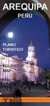
AREQUIPA
TOURIST MAP Presentation: printed infull color Size: sheet of 42 x 60 cm, folded to 10 x 21 cm Scale: 1:15,000 (approx.; downtown area) Contents: 3D map of Metropolitan Arequipa plus detail maps of downtown section; textual information on history, places to visit, lodging, restaurants, useful addresses, excursions. Languages: English and Spanish (bilingual edition) |
![]()
|
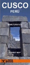
CUSCO
TOURIST MAP Presentation: printed infull color Size: sheet of 42 x 60 cm, folded to 10 x 21 cm Scale: 1:10,000 (approx.; downtown area) Contents: 3D map of Cusco Region plus detail maps of downtown section; textual information on history, places to visit, lodging, restaurants, useful addresses, excursions. Languages: English and Spanish (bilingual edition) |
![]()
|
LIMA
TOURIST MAP Presentation: printed in full color Size: sheet of 42 x 60 cm, folded to 10 x 21 cm Scale: 1:12,500 (aprox.; downtown area) Contents: 3D map of Metropolitan Lima plus detail maps of downtown section, San Isidro and Miraflores; textual information on history and urban development, places to visit, lodging, restaurants, useful addresses, excursions. Languages: Spanish an English (bilingual edition) |
 |
|
INCA
TRAIL / SACRED VALLEY (CUSCO) Presentation: printed infull color Size: sheet of 42 x 60 cm, folded to 10 x 21 cm Contents: Topographic map of the Inca Trail (with detailed map of Machu Picchu and Aguas Calientes); 3D panoramic map of the entire region, including Cusco, Sacred Valley, Machu Picchu and Choquequirau; textual information on history, hikes and excursions, places to visit, lodging, restaurants, typical food an local events. Languages: English and Spanish (bilingual edition) |
![]()
|
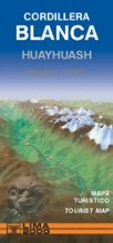
CORDILLERA
BLANCA / HUAYHUASH (HUARAZ) Presentation: printed infull color Size: sheet of 42 x 60 cm, folded to 10 x 21 cm Scale: 1:250,000 (approx.) Contents: overal road map including trail and tourist information; details map of Huaraz; textual information on history, hikes and excursions, places to visit, lodging, restaurants, typical food an local events. Languages: English and Spanish (bilingual edition) |
![]()
|
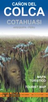
COLCA-COTAHUASI
CANYON (AREQUIPA) Presentation: printed infull color Size: sheet of 42 x 60 cm, folded to 10 x 21 cm Contents: Maps of Colca and Cotahuasi canyons (scale 1:225,000), with trekking routes and tourist services; Panoramic map of the region; textual information on history, excursions, places to visit, lodging, restaurants, typical food, calendar of holidays and events. Languages: English and Spanish (bilingual edition) |
 |
|
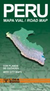
PERU ROAD MAP Presentation: Printed in Couche paper at full colors, index and distance chart Size: sheet of 70 x 100 cm, folded to 10 x 23.5 cm Contents: roads according to surface (paved, unpaved, dirt road); total and partial distances in km for all road segments; political boundaries; cities and towns according to number of inhabitants; rivers, lakes, archeological sites, tourist attractions, airports, mines etc. Use: in the car, for travel planning |
![]()
|
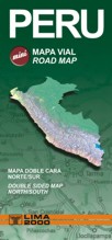
PERU MINI ROAD MAP VIAL Presentation: Printed in Couche paper at full colors, index and distance chart Size: sheet of 42 x 60 cm, folded to 10 x 21 cm Contents: roads according to surface (paved, unpaved, dirt road); total and partial distances in km for all road segments; political boundaries; cities and towns according to number of inhabitants; rivers, lakes, archeological sites, tourist attractions, airports, mines etc. Use: in the car, for travel planning |
![]()
SOON TO BE PUBLISHED:
 |
- Hard copy or digital cartography - Scale and design according to special needs - With information provided by the user Special Maps are based on the georeferenced data from à Centro de Promoción de la Cartografía en el Perú (CPCP) |
a. Processing of existing addresses We stadarize the
addresses contained in your databases
according to the same criteria applied in
elaboration of our street maps. In a
second step, we process the rejected
addresses semi-automatically, and
separate the invalid ones The geocoding process consists in assigning real geographic coordinates to each address, and creating a layer of points that can be placed on top of a digital street map. The result allows easy sectorizing or route-planning for distribution and sales. By adding layers containing other information such as location of branch offices or statistic populaton data, the map turns into a very powerful tool for marketing analysis and similar tasks. |